Knock Hill Circular Hike - Largs
| Ascent: | 331m |
| Distance: | 13.38km |
| Type: | Hike |
| Difficulty: | Easy - Moderate |
| Duration: | 2.5-4 hours |
| Elevation: | 331m |
| GPX File: | Download |
Route map
Route Elevation Profile
Description
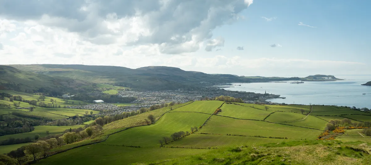
The Knock hill circular route starts off in Largs and takes you up and around Knock Hill. The route is a mix of road, track and path and offers great views over the Firth of Clyde, the Isle of Cumbrae, and over to Goatfell on the Isle of Arran.
There are some areas where the path can be quite boggy so make sure you’re prepared to get your feet wet!
Starting Point
The starting point for this hike is in Largs - we chose to park at the Inverclye Sports Centre car park which is free to park in. There are a few overflow sections and features a few electric car chargers if you need them.
Route
The route starts off by heading down the hill from the carpark in the sports centre and then right down Burnside Way before taking a left down Laverock Drive. At the end of Laverock Drive, you’ll want to turn right and head along Brisbane Glen Road.
You’ll eventually get to a fork in the road where you’ll want to take the left fork and head up the farm path towards Knock Hill. The path is fairly easy going and you’ll be treated to some lovely views of the surrounding hills and back down to Largs.
The area sounding Knock Hill is known as Brisbane Mains and is an active reforesting area. You can read more about this here - Brisbane Mains. It was a gratifying experience seeing the ongoing work, that I’ve played a tiny part in funding, in the flesh.
You’ll eventually come to a fork on the path where you’ll want to take the left fork and continue heading up the gradual incline towards the top of Knock Hill. You’ll eventually see an obvious and direct path up to the summit, or if you’re wanting a more leisurely walk, you can continue around to the left of the hill which circles the summit.
Once you’ve taken in the views at the top of Knock Hill and booped the trig point, you then need to double back on yourself back to the fork.
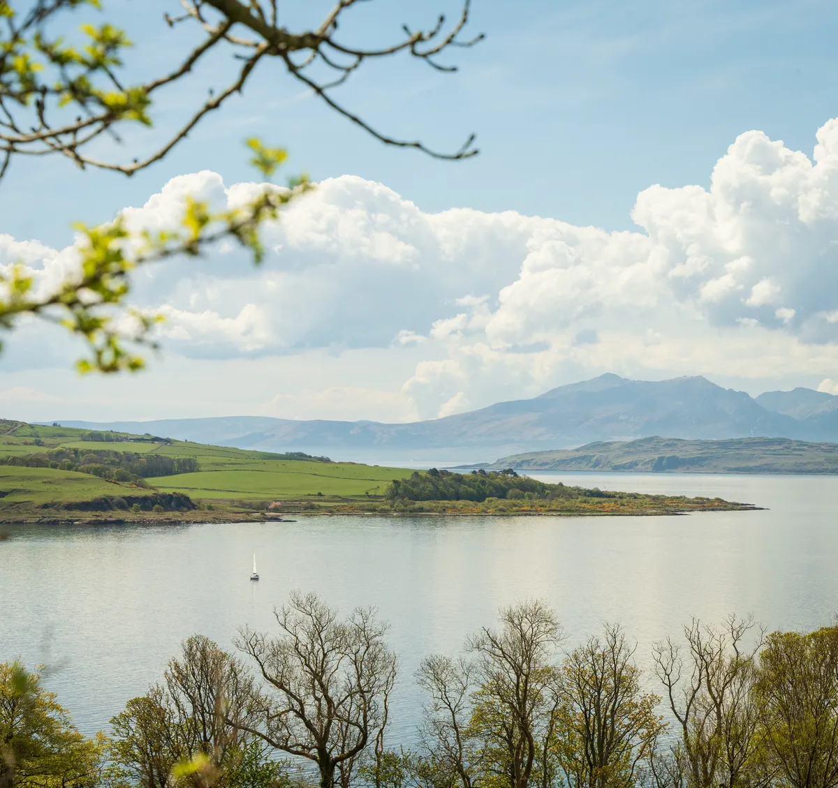
the views across the Firth of Clyde
Take the right fork this time which will take you west through some kissing gates towards Routenburn Road. When you reach this road, you will want to head left and follow this back into Largs.
You’ll eventually pass by a hotel/bar called The Woodhouse which is an excellent pit-stop to grab a snack or a drink before heading back to the car park.