Braes of Foss car park on the minor road between Tummel Bridge and Coshieville. Managed by the John Muir Trust — charges apply. Toilets on site. Overflow car park further along the road if the main one is full.
You can see Schiehallion from miles away. That near-perfect conical profile rising above Loch Rannoch is one of the most recognisable silhouettes in Scotland — the kind of mountain that looks like a child drew it. From the west, you’d think it was impossible to climb. But approach from the east and you’ll discover a long, gentle ridge that makes this one of the most popular and accessible Munros in the country.
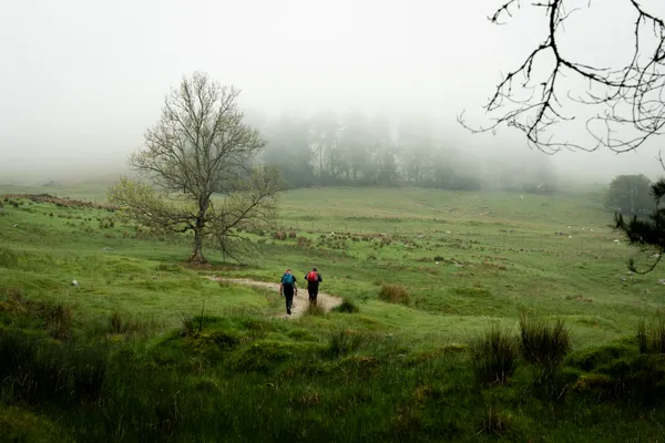
We brought a novice hiker with us on this one to help him bag his first Munro, and Schiehallion delivered exactly what we’d hoped — a proper mountain experience with a manageable challenge and views that made him immediately want to do another.
Route Overview
- Schiehallion — Munro — Fairy Hill of Caledonia — 1,083m
- Total distance: 10km (out and back)
- Total ascent: 731m
- Moving time: ~4 hours
- Difficulty: Moderate — well-maintained path with a rough boulder field near the summit
| Munro Name | Pronunciation | Translation | Height |
|---|---|---|---|
| Schiehallion | She-hal-yun | Fairy Hill of Caledonia | 1,083m |
The route is an out-and-back from the Braes of Foss car park on the eastern side. The path climbs steadily up the long east ridge, crossing a quartzite boulder field in the final 2km before the summit. Navigation is straightforward in clear weather, though the boulder field can be tricky in mist.
A Bit of History
If you’re climbing Schiehallion, it’s worth knowing you’re walking on historically significant ground.
In 1774, the Astronomer Royal Nevil Maskelyne chose this mountain for an experiment to estimate the mass of the Earth — an idea first proposed by Isaac Newton. Schiehallion was selected because of its isolated position and remarkably symmetrical shape, which made it possible to calculate the mountain’s own mass and use it to measure gravitational deflection on a pendulum. The experiment was a success and led directly to the invention of contour lines, which were first drawn to map Schiehallion’s shape. Every OS map you’ve ever used owes something to this mountain.
I’d recommend reading more about the Schiehallion Experiment — it’s a genuinely fascinating story.
Getting There and Parking
The Braes of Foss car park sits on the minor road between Tummel Bridge and Coshieville, in the heart of Perthshire. From Perth it’s about an hour’s drive; from Glasgow or Edinburgh, closer to two hours.
The car park is managed by the John Muir Trust, who have owned the eastern side of the mountain since 1999. There’s a charge for parking and toilets on site. It’s a relatively small car park and fills up quickly given Schiehallion’s popularity — if the main car park is full, there’s an overflow a little further along the road.
We took a slightly different approach and arrived at around 2pm, just as the early starters were coming back down. We had no trouble finding a space. I’d only recommend this during summer when you have enough daylight to complete the hike comfortably — on a July evening we had plenty of light.
The Path — Braes of Foss to the Ridge
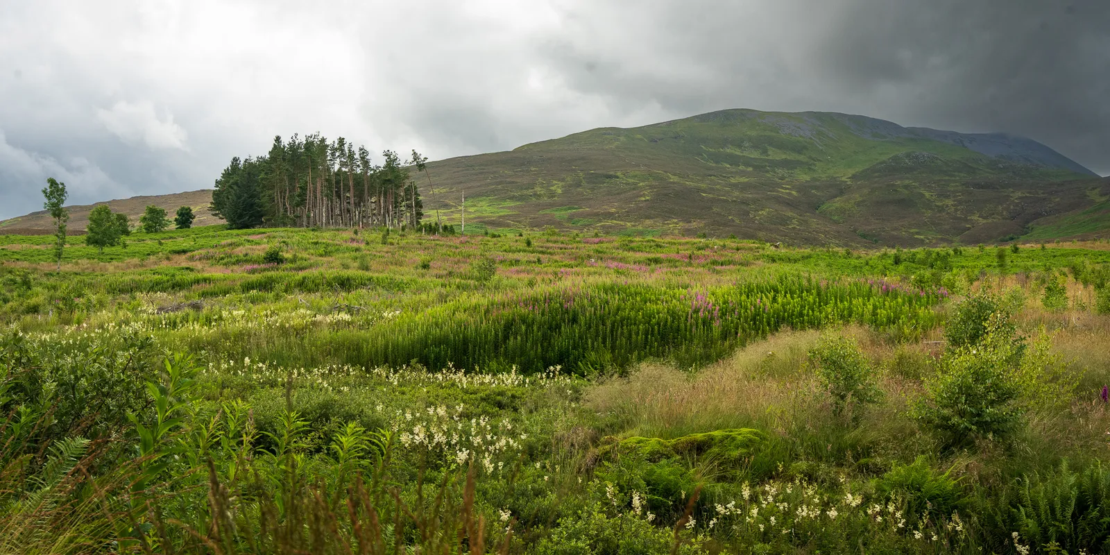
The first section of the hike follows a beautifully maintained path that climbs steadily through heather and moorland. The John Muir Trust spent around £800,000 restoring this path after the original route had eroded into an ugly scar up to 90 feet wide. The result is one of the best-maintained mountain paths in Scotland — clearly built with care, using locally sourced stone, and it shows.
The well-maintained path climbing Schiehallion's eastern ridge
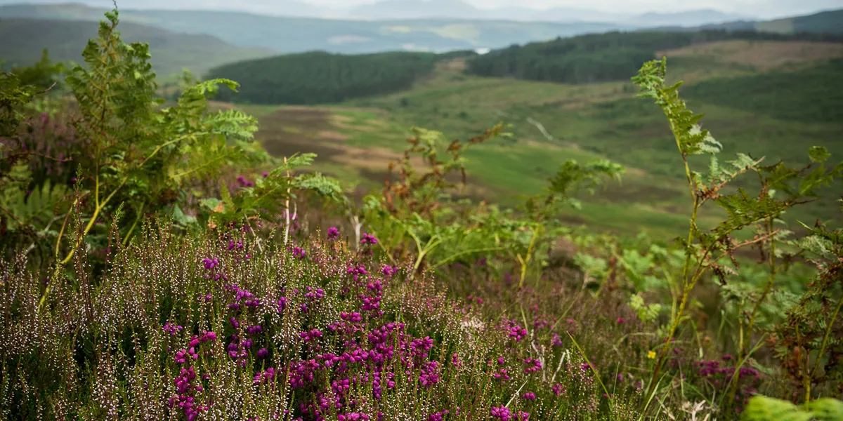
As you gain height, views open up behind you across Loch Tummel and towards the distant hills of the Cairngorms. The gradient is steady but never brutal — a welcome contrast to something like Ben More, where the ascent is relentless from the first step.
This is the stretch that makes Schiehallion such a good first Munro. The path is clear, the footing is solid, and you can settle into a rhythm and enjoy the views without worrying about navigation. Our novice hiker was grinning by this point — the combination of fresh air, expanding panorama, and the satisfying feeling of making progress up a real mountain had done its thing.
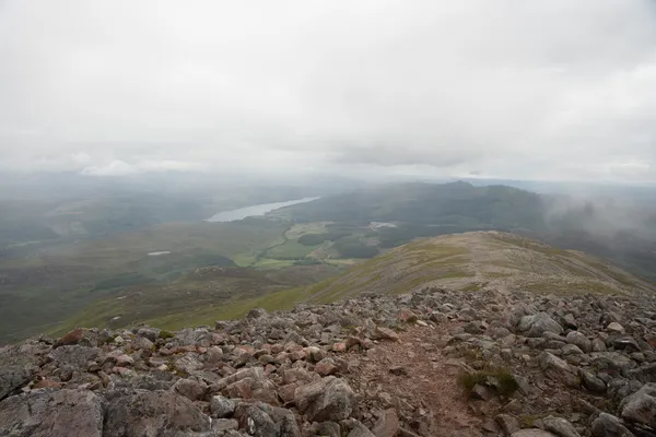
Views opening up across Loch Tummel during the ascent of Schiehallion
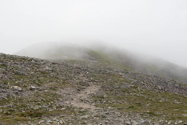
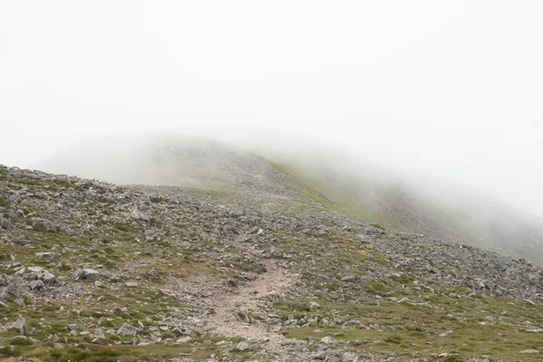
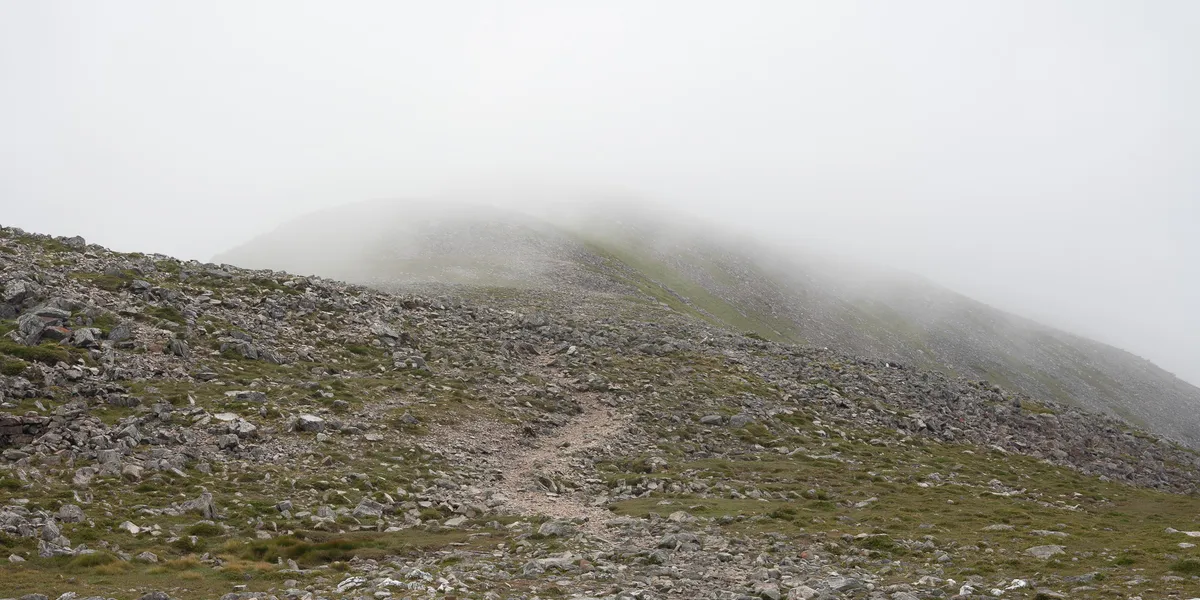
The Boulder Field
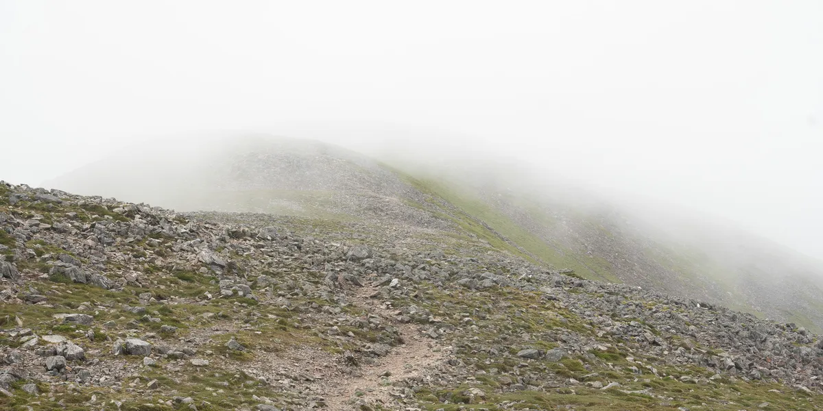
At around 870m, the well-maintained path runs out and the character of the hike changes completely. The final 2km to the summit crosses a quartzite boulder field — angular white rocks scattered across the ridge that make for awkward, ankle-twisting terrain.
This section catches people out. After the beautifully smooth path lower down, suddenly you’re picking your way over loose rocks with no clear line to follow. In mist, it’s easy to lose the route entirely, so keep your navigation to hand. In clear weather, you can generally see the summit and just aim for it, hopping from boulder to boulder.
The quartzite boulder field on Schiehallion's upper ridge
Take your time here. The rocks are angular and unforgiving if you take a tumble, and tired legs on the descent make this section the most likely place to roll an ankle. Our novice found this the toughest part of the day — not because of fitness, but because the terrain demanded constant attention to foot placement.
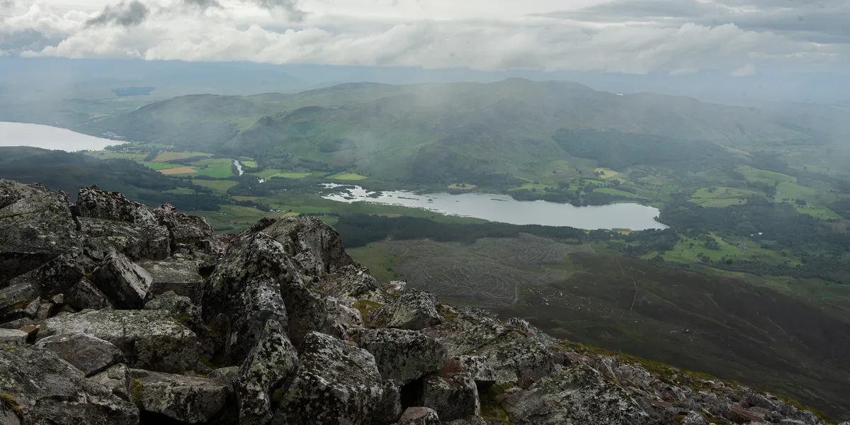
The boulder field seems to go on longer than you’d expect. Just when you think you must be nearly there, there’s another stretch of white rock ahead. But the views from up here — across Rannoch Moor to the Glencoe peaks, and down to Loch Rannoch below — are increasingly stunning as motivation.
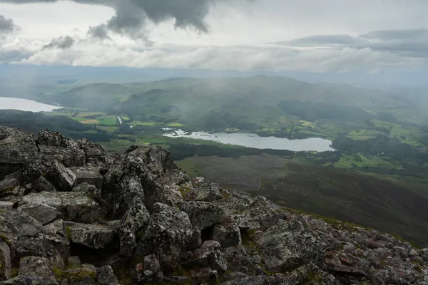
Schiehallion Summit — 1,083m
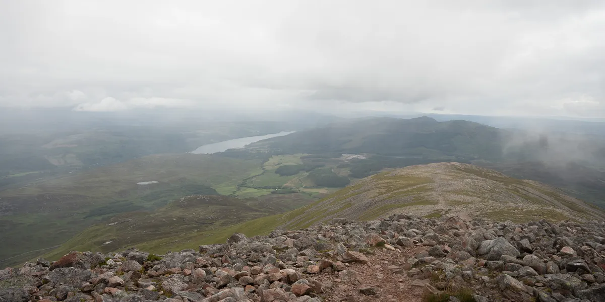
The summit sits at 1,083m and is marked by a cairn perched among the quartzite boulders. It’s worth continuing a few metres beyond the cairn for the best views down over Loch Rannoch — the loch stretches out below you with the vast emptiness of Rannoch Moor beyond it, and on a clear day the peaks of Glencoe are visible on the horizon.
Summit views from Schiehallion looking over Loch Rannoch
To the east, the Ben Lawers range dominates the skyline above Loch Tay. To the south, you can pick out Stuchd an Lochain and Meall Bhuide in the Glen Lyon hills. The sense of isolation up here is real — Schiehallion stands apart from its neighbours, so the panorama is uninterrupted in every direction.
We sat and had a bite to eat, grabbed some photos, and watched our novice hiker take in his first proper summit view. He was hooked. There’s something about that first time standing on top of a Munro that changes your relationship with the mountains — and Schiehallion is the perfect place for that to happen.
Looking out from the summit of Schiehallion
The summit is exposed though, so on days when the weather is less than cooperative, you won’t want to linger. Bring warm layers and a windproof jacket regardless of conditions at the car park — it’s a different world up here.
The Descent
The return follows the same route back down. The main thing to watch is the boulder field — tired legs and loose rock are a recipe for a twisted ankle, so take it slowly and pick your footing carefully.
Once you’re back onto the maintained path below 870m, the descent is pleasant and quick. The path is easy on the knees compared to steeper mountains, and the views of Loch Tummel ahead of you make for a lovely end to the day.
When to Climb Schiehallion
Summer (May–September) is ideal. Long days give you flexibility on timing — you can even start in the afternoon as we did. The path is at its driest, though the boulder field is unaffected by seasons.
Autumn (October–November) brings golden bracken on the lower slopes and often crystal-clear visibility. The shorter days mean you need to start earlier, but the mountain is quieter and the light is spectacular for photography.
Winter (December–March) is a different proposition. The boulder field becomes significantly more dangerous when covered in snow and ice — the angular quartzite hides under a layer that can look solid but isn’t. Crampons and an ice axe are essential, and navigation in mist across a snow-covered boulder field is genuinely challenging. That said, experienced winter walkers will find that a good covering of consolidated snow actually makes the boulder field easier to cross, as it fills in the gaps between rocks.
Spring (March–April) can be a mix of lingering snow on the upper sections and boggy conditions lower down. Check MWIS forecasts and be prepared for winter conditions above 800m.
Combine With
Schiehallion is usually a standalone day out. The nearest Munros with posts on this site are the Glen Lyon group — Stuchd an Lochain and Meall Bhuide share a car park at Loch an Daimh, about 30 minutes’ drive to the south-west. The Ben Lawers range and Meall Corranaich are accessible from the other side of Loch Tay.
If you’re making a weekend of it, the Pitlochry area has plenty of accommodation and the drive to any of these is under an hour.
Tips for This Route
- The boulder field is the crux. Everything before it is straightforward, but the final 2km demands concentration. Watch your ankles.
- Start early or start late. The car park fills by mid-morning on good-weather weekends. We arrived at 2pm and had no issues, but only do this in summer when you have the daylight.
- Bring trekking poles. They’re a genuine help on the boulder field, both ascending and descending.
- The path is a privilege. The John Muir Trust invested heavily in restoring it — stay on the marked path on the lower sections to protect the hillside.
- Check the forecast for cloud level. In clear weather, the boulder field is manageable with visual navigation. In mist, it’s a different experience entirely — bring a map and compass.
Frequently Asked Questions
Is Schiehallion a good first Munro? One of the best. The well-maintained path, steady gradient, and spectacular summit views make it a fantastic introduction to Munro bagging. We brought a complete novice and he completed it in just over 5 hours. Ben Lomond and The Cairnwell Munros are other good options for a first attempt.
How long does Schiehallion take? Allow 4–6 hours round trip. We completed it in about 5 hours with a novice, including a good stop at the summit. Fitter walkers can do it faster, but the boulder field slows everyone down regardless of fitness.
Where do you park for Schiehallion? Braes of Foss car park on the minor road between Tummel Bridge and Coshieville (PH16 5NP). Managed by the John Muir Trust. There’s an overflow car park further along the road if the main one is full.
How do you pronounce Schiehallion? “She-hal-yun” — it comes from the Gaelic Sìdh Chailleann, meaning “Fairy Hill of Caledonia.”
Is Schiehallion suitable for dogs? The lower path is fine for dogs. The quartzite boulder field near the summit is more problematic — the angular rocks and gaps between boulders can be difficult for dogs to navigate, and the sharp edges aren’t kind on paws. Some people do bring dogs up and over the boulders, but assess your dog’s comfort on rocky terrain before committing. Keep them on a lead through any areas with livestock.
Is the boulder field really that bad? It’s not dangerous, but it’s tiring and slow. The angular quartzite rocks are loose in places and you need to pick your route carefully. It goes on for about 2km, which is longer than it sounds when every step requires concentration. Good boots with ankle support are essential.